

East and West Jersey, their impact decades after proprietary colonies dissolved
How 17th Century Colonies are still relevant in Revolutionary New Jersey…and today?
When it comes to regional competitions and contrasts in New Jersey, we tend to think in terms of north and south. Yet the historical Province of New Jersey was partitioned into the colonies of East New Jersey and West New Jersey. Even as British and American armies vied for control of the region during the Revolutionary War, the distinction between East and West Jersey prevailed!
What is a Proprietary Colony?

The History
In June 1664, James, Duke of York (brother of King Charles II of England) granted all the land between the Hudson and Delaware rivers to two loyal family friends, Lord John Berkeley and Sir George Carteret.
Each man held a half-right to what was, henceforth, to be called “New Jersey or Nova Cæsarea.”
While the Dutch still occupied this territory as part of the New Netherland colony, they would surrender it to the English very soon afterward.
Berkeley’s and Carteret’s interests in New Jersey were acquired by investors, or proprietors.
The East Jersey Proprietors and West Jersey Proprietors established the governments of the colonies directly, including appointing governors, with permission from the British Royal Government.
This is different from a Royal Colony, where the government is directly appointed by the Crown.

The Lawrence Line
In 1743, the East Jersey Proprietors hired John Lawrence, a surveyor from Monmouth County to completely survey a straight line between 41 degrees latitude on the Delaware River and the southernmost point of Little Egg Harbor.
The line's bounds were described in 1676 Quintipartite Agreement between East and West Jersey Proprietors, two New Jersey land corporations. It established where each corporation owned land and could oversee and conduct land transactions. The 67 year gap between the Quintipartite Deed and Lawrence's survey lead to many property disputes.
In 1777, the Lawrence Line was and remained the only fully surveyed boundary between the territories of the two corporations, and remained an important part of both past and future land sales in the area.
Explore more of this 1777 map!
The Division Line
In 1686, the proprietors moved forward with surveying a “Province Line.” Learn more about the history of this division line by clicking on the bright yellow line on the map.
The government and the first counties and municipalities were administered in the framework of two colonies, East and West Jersey, which were divided according to this line. Each had its own capital.
East Jersey’s seat of government was initially set up in Elizabeth-Town, then relocated to Perth Amboy.
West Jersey’s capital was the City of Burlington.

Royal Colony established, but Proprietors still standing

A Tale of Two Capitals
In 1702, New Jersey’s proprietors surrendered governance of the province but retained their land rights.
Queen Anne appointed her cousin Edward Hyde, Lord Cornbury, as New Jersey’s first royal governor at that time.
He was charged with establishing a governing structure directly accountable to the Crown.
With two existing capitals and the proprietors’ land rights intact, the distinction between East and West New Jersey continued throughout the 18th century.
The executive, legislative, and judicial branches of colonial government simply conducted their business back and forth between Perth Amboy and Burlington.
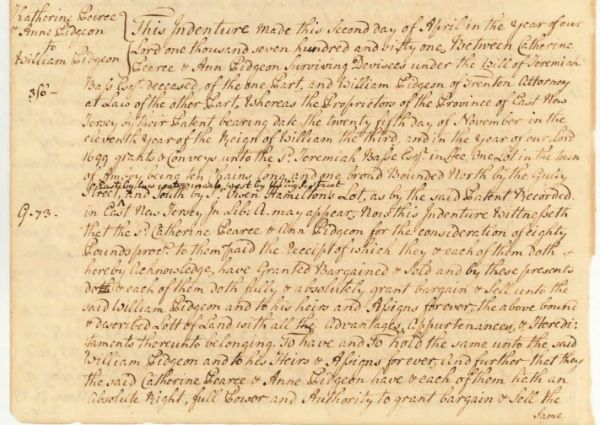
Each division had its own Deputy Provincial Secretary, and separate East and West record books were kept, for court proceedings, land transactions, and estates. You may view these records in various collections at the New Jersey State Archives.
Trenton becomes our singular capital
On November 25, 1790, the State of New Jersey designated Trenton as its capital and relocated the operations of government. Our first State House was completed two years later. Portions of it are still in use today, within the structure of the present-day State House Complex.

In 1795 the Legislature authorized a second public building to be constructed on the State House lot so that New Jersey’s public archives, finally, could be centralized in one place!
Relevance, Revolution to Today

The Faden Map
We typically think of East and West New Jersey as 17th-century phenomena, but this is not true.
William Faden’s 1777 map of the state, published a year after New Jersey declared its independence from Great Britain, is an example.
Even though the proprietary colonies had not existed for more than seventy years, the Faden map is titled The Province of New Jersey, Divided into East and West, commonly called The Jerseys.
Click on the map to see a larger version, from Library of Congress.
Legacy of the Proprietors
References to the east-west division of New Jersey are common in land documents well into the 19th century.
In fact, even today, reversionary rights to unclaimed land are based on the original proprietorships, of which the West Jersey Proprietors still exist as a corporation. As for the ancient province lines, vestiges of them can be seen today in road names and rights-of-way, and as segments of county and municipal boundaries.
Questions for Discussion
- Which proprietary colony do you live in? East or West Jersey?
- Do you think the state should have retained its two original capitals of Burlington (West Jersey) and Perth Amboy (East Jersey)? Where would you choose to put New Jersey’s capital today?
- Look at John Sellers’ map of East and West “Jarsey”. It’s oriented different than most maps of the state. Do you find it easier to see the territories of the two colonies on this map?
Share your thoughts with us on New Jersey history.

Continue your journey, below, into New Jersey state history




In Partnership
An Online Exhibition from the NJ State Library, in partnership with the New Jersey State Archives.

